In our courses and training sessions , we always say that a journey begins at home. We must prepare every aspect of it so we don't have surprises or incidents or emergencies that could put our safety and that of those around us at risk.
This doesn't mean we spend days planning the route, but rather it's done quickly and easily.
The first thing is to answer a few simple questions
- Where am I going? Where am I going? (low mountains, coast, mid-mountain, high mountains)
- Where? Marked paths, trails, official hiking trails, I make my own way.
- How? Am I going alone, with someone, as a couple, or are we a large group? Is it a one-day or multi-day route?
- When? In summer, winter, spring, or fall
By answering these simple questions, we'll have part of the team chosen for the activity and part of the activity prepared.
Now let's see how we can use the map to determine if the activity we're going to do can be completed in one day or how long it might take to complete.
For this calculation, we'll need to identify the route on a map and know the distance to be traveled, as well as the total elevation gains and losses .
Knowing the total timetable and being able to plan your route from point to point will allow you to know during the route if you're on time or if you'll have to turn back because you won't be able to stick to the schedule and night will fall on you, with all the risks that entails.

We have to decide what time we will start walking, taking into account whether we are going alone, or in a group, or the weather conditions we are going to encounter,
(we will walk better on a spring day with good temperature, than on a winter day with rain and wind)
What do we need to do time calculations?
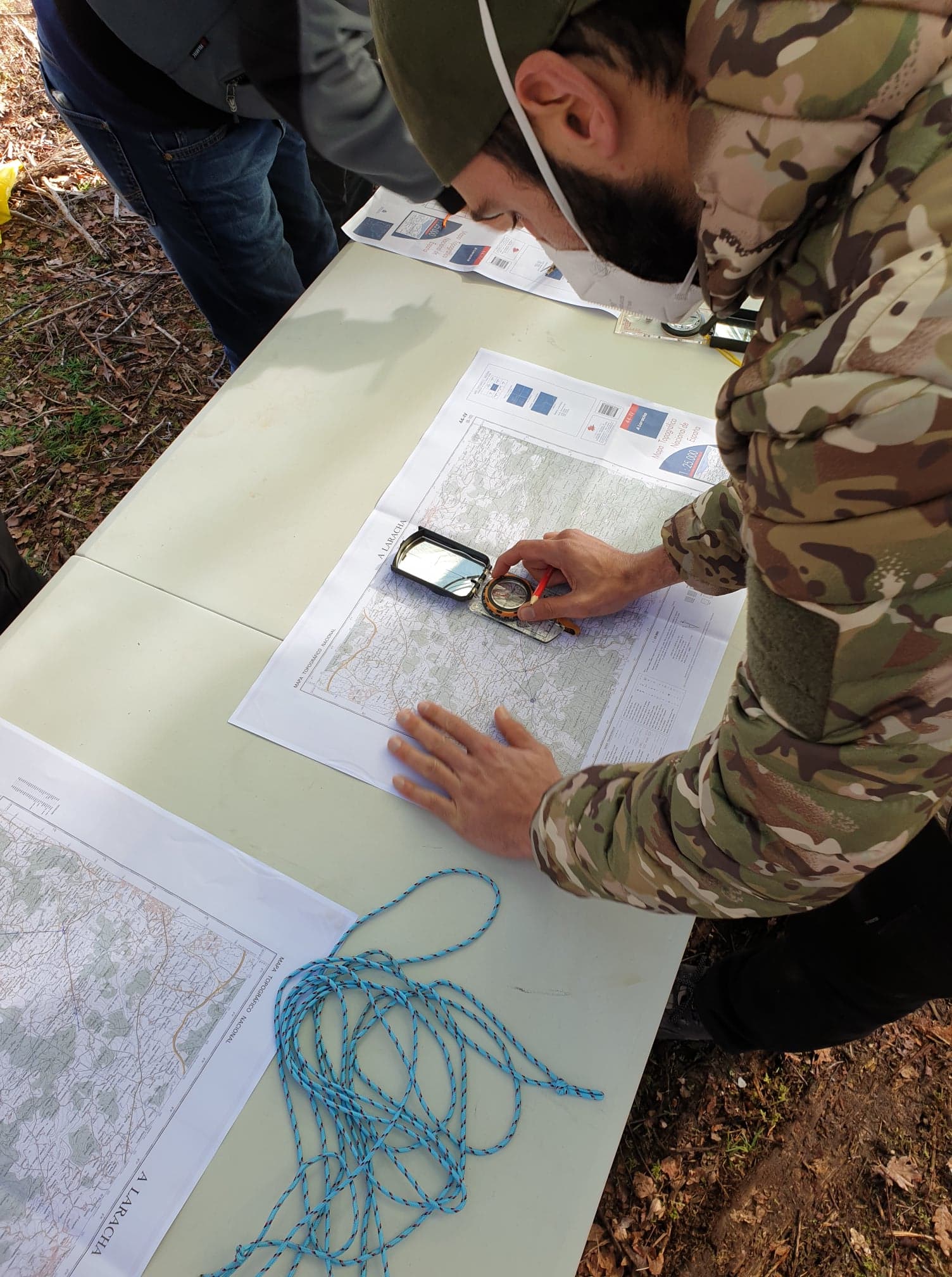
- Identify the route on a map (1:25000) or (1:50000) are the most used
- Have basic knowledge of map reading, contour lines, and know how to calculate positive and negative elevation changes.
- Search for route information , in case it has complicated steps, or route status
(remember that the real terrain is always more complicated than a 2D map)
Get distances and elevations
Remember that we can measure 3 types of distances
- Reduced
- Geometric
- Real or topographical
Once we have a clear idea of the route and what we need to measure, we will need to know two types of information about the map.
1. The distance in kilometers to be traveled: Measure on the map using a ruler, scale, or distance cord. Always keep in mind the scale of the map you are working with. This can be seen on the map's graphic scale.
2. Cumulative elevation changes, positive and negative , in meters. You must calculate the number of contour lines to overcome on the map, taking into account the number of meters between each curve, depending on the map scale. Then, convert the number of curves into accumulated elevation changes.
- On 1:25,000 maps the equidistance between curves is 10 meters, and on 1:50,000 maps it is 20 meters.

For the “unevenness” value:
You need to get two values: cumulative positive elevation gain and cumulative negative elevation gain.
The same route can have successive ascents and descents, so we need to observe where the route runs and add up the positive and negative elevation gains separately.
If we find that the route always climbs to the summit and then descends to the starting point, you can simplify the measurement by subtracting the minimum elevation from the maximum elevation. The resulting data will serve as both positive and negative elevation gain data.
On a route (round trip or circular) the ascent gradient should be equal to the descent gradient.
Once you have the distance data in (kilometers), and positive and negative accumulated elevation gains (in meters), it's time to calculate the time it will take on the route.
For each section we will calculate two schedules
- one on the distance to be covered
- another about the slope to overcome
We will apply the following calculation values.
1 Distance to travel. Depending on the type of road (dirt road, asphalt, trail, paved road, etc.), we will calculate the (horizontal time) based on:
- Roads and tracks : An average person can walk at a normal pace at 5 km/hour
- Paths, trails and meadows: You can advance at 4 km/hour
- Bad trails , closed trails and riverbeds: estimate that you are moving at 3 km/hour

2 Elevation gain . Depending on whether we're talking about meters of elevation gain going up or down, we'll calculate the "vertical time" as follows:
- Time for the accumulated positive gradient (sum of all the meters of gradient that we must overcome while ascending): estimate that we ascend at 400 meters/hour
- Time for the accumulated negative gradient (sum of all the meters of gradient that we must overcome in descent): estimate that we descend at 600 meters/hour
With these two times calculated ("horizontal time" and "vertical time") we will obtain the total time by choosing the longest time and adding half of the shortest.
Always remember to add up the stop times (of course this depends on each person)
- - 50 minutes walk / 10 minutes stop
- - 3 hours of route / half hour break
Remember that if children are going, we'll have to add more time to the route and always walk at the slowest pace; we should never leave anyone behind.
If we doubt that we won't have time to complete the route during the day, we'll have to turn back. The highest number of rescues is of people who get lost at night.
Of course all this is a guideline, each of us knows the pace we walk and how we climb the hills, in my case I always apply the saying
(Climb like an old man, to reach the top like a young man)